
Floodwater harvesting of the Arghastan River basin of Kandahar in Afghanistan

DOI:
https://doi.org/10.54060/jmce.2023.48Keywords:
Contour map, dam site, reservoir capacity, surface runoffAbstract
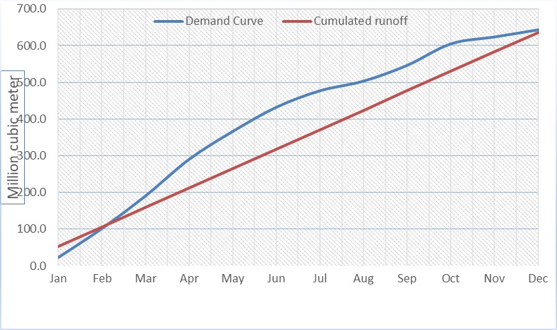
Climate change and population growth are the important factors that place additional pressures on water resources, and generally, predictions indicate that these pressures are increasing continuously, so it is necessary to regulate surface water sources. Afghanistan has a semiarid climate and already received worse effects of climate change; therefore, there is an extremely needed regulation of river flow across the country. Arghastan River is in the southern west parts of the country, thousands of cubic kilometers of water in this river are wasted annually, and drought and floods are the main problems of the residents due to nonmanagement of river flow. The main objective of the study conducted by GIS was to find a dam site along the river for proper water management. A contour map was created for the entire watershed by using 5-meter DEM, that the most suitable site for the dam is at the coordinate of 66°48'34.468"E 31°35'4.512"N, it is possible to build up to 170-meter-high dam. The purpose site of the reservoir has the capacity to store about 1700 million cubic meters of water at an elevation of 170 meters, while the average monthly discharge of the Arghastan River up to the specific point of the investigation is about 38.6 m3/s. Suppose the floodwater of this River basin is harvested. In that case, it will provide the chance for residents to rescue their property from flood hazards during the rainy season, and they will have enough water for irrigation purposes during the summer season.
Downloads
References
J. A. N. Shokory, B. Schaefli, and S. N. Lane, “Water resources of Afghanistan and related hazards under rapid climate warming: a review,” Hydrological Sciences Journal, vol. 68, no. 3. Taylor & Francis, pp. 507–525, 2023. doi: 10.1080/02626667.2022.2159411.
O. Almasalmeh, A. Adel, and K. A. Mourad, “Floodwater harvesting within Wadi Billi, Egypt,” Water Sci., vol. 36, no. 1, pp. 98–112, 2022, doi: 10.1080/23570008.2022.2129150.
G. Ghahari, H. Hashemi, and R. Berndtsson, “Spate irrigation of barley through floodwater harvesting in the gareh-bygone plain, Iran,” Irrig. Drain., vol. 63, no. 5, pp. 599–611, 2014, doi: 10.1002/ird.1855.
O. O. Magnus, “Assessment of Rain Water Harvesting Facilities in Esanland of Edo State, Nigeria,” J. Hum. Ecol., vol. 34, no. 1, pp. 7–16, 2011, doi: 10.1080/09709274.2011.11906363.
S. R. Ahmad, U. Ahmad, and A. Masood, “Geo-Spatial Techniques in selection of potential Damsite,” Pak. J. Sci., vol. 65, no. 1, pp. 158–166, 2013.
T. Sawunyama, A. Senzanje, and A. Mhizha, “Estimation of small reservoir storage capacities in Limpopo River Basin using geographical information systems (GIS) and remotely sensed surface areas: Case of Mzingwane catchment,” Phys. Chem. Earth, vol. 31, no. 15–16, pp. 935–943, 2006, doi: 10.1016/j.pce.2006.08.008.
S. K. Jain and S. K. Jain, “Assessment of reservoir sedimentation using remote sensing,” IAHS-AISH Publ., vol. 349, pp. 163–170, 2011.
D. Ramakrishnan, A. Bandyopadhyay, and K. N. Kusuma, “SCS-CN and GIS-based approach for identifying potential water harvesting sites in the Kali Watershed, Mahi River Basin, India,” J. Earth Syst. Sci., vol. 118, no. 4, pp. 355–368, 2009, doi: 10.1007/s12040-009-0034-5.
Downloads
Published
How to Cite
CITATION COUNT
Issue
Section
License
Copyright (c) 2023 Abdul Wali Hejran, Ahmad Shah Dawari

This work is licensed under a Creative Commons Attribution 4.0 International License.